In the past 24 hours, the Popocatepetl volcano recorded 12 exhalations, according to monitoring by the National Center for Disaster Prevention (Cenapred).
Thefederal authorities recommend that the population ignore rumors and be attentive to information issued by the National Civil Protection Coordination through its official channels and accounts: www.gob.mx/cenapred and @CNPC_MX en Twitter.
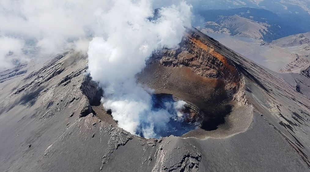
There are at least 46 active volcanoes in the country, but only six are identified as high risk by Cenapred, so it monitors its activity to react in a timely manner in the event of an emergency or a major eruption.
The high-risk volcanoes are: the Popocatepetl; the Fuego Volcano, in Colima; the Ceboruco, in Nayarit; the Pico de Orizaba, on the border of Veracruz and Puebla; the Chichón, in Chiapas and the Tacana, which is on the border with Guatemala.
In the event of a larger Popocatepetl explosion, it would not trigger a chain detonation because each volcano is independent, each has its own conduits, its own magma sources, which are not directly related, so that the activity of a volcano will not affect either up or down the activity of other volcanoes.
Cenapred Volcanic Alert Traffic Light
is the body responsible for constantly monitoring the activity of the country's volcanoes, determining the levels of dangerousness and in this way it can issue preventive safety measures.
In the case of Amarillo Phase 2, this means that there is an increase in activity with the presence of steam and gas plumes, ash fall, incandescent fragments, creation and destruction of lava domes, pyroclastic flows and short-range sludge and debris flows. The other two phases have the following characteristics:
Green
In this phase there is little or no activity that only has on the recommendation of the Commission that villagers be kept informed about evacuation routes, assembly points and temporary shelters. In its first phase, the volcano is considered to be calm and in the second phase it is considered to have minimal manifestations or spontaneous seismic activity.
Red A Red
Volcanic Alert is not only a warning signal, it is also a sign that the authorities and the population must begin to evacuate areas that may be affected in the event of an explosion of the colossus. In its first phase, it is considered that there is an intermediate to high hazard that presents eruptive columns of several kilometers, as well as significant ash fall and pyroclastic and mud flows in nearby areas.
More news
Últimas Noticias
Debanhi Escobar: they secured the motel where she was found lifeless in a cistern
Members of the Specialized Prosecutor's Office in Nuevo León secured the Nueva Castilla Motel as part of the investigations into the case

The oldest person in the world died at the age of 119
Kane Tanaka lived in Japan. She was born six months earlier than George Orwell, the same year that the Wright brothers first flew, and Marie Curie became the first woman to win a Nobel Prize

Macabre find in CDMX: they left a body bagged and tied in a taxi
The body was left in the back seats of the car. It was covered with black bags and tied with industrial tape

The eagles of America will face Manchester City in a duel of legends. Here are the details
The top Mexican football champion will play a match with Pep Guardiola's squad in the Lone Star Cup

Why is it good to bring dogs out to know the world when they are puppies
A so-called protection against the spread of diseases threatens the integral development of dogs