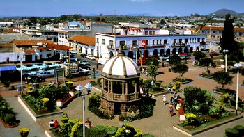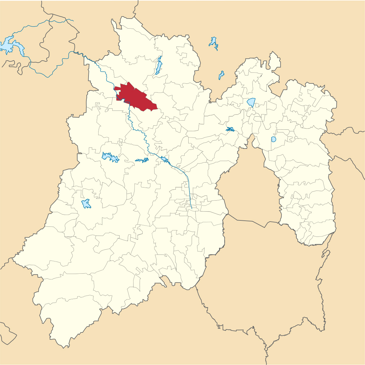
Atlacomulco is one of the many outstanding places that make up the list of the 125 municipalities that make up the State of Mexico. It is located to the northwest of the state and 126 kilometers from Mexico City. It borders the territories of Acambay, Timilpan, Jocotitlán, Temascalcingo and Morelos.
According to the National Institute for Federalism and Municipal Development (INAFED) the name is composed of the words Atlacomulli which means “well”, and co which means “place”, the general translation is “place where there are wells”. However, the first name of the site was Ambaró which means “piedra colorada”, a title given to it by the Mazahua people before the Nahuas conquered them.
The origins of this region date back to prehistoric times, that is, more than 10,000 years ago. This is known thanks to various research carried out by the National Institute of Anthropology and History (INAH) due to the fact that, thanks to a series of excavations, mastodons, ancient horses, mammoth bones, as well as conifers, shrubs and other flora of the Quaternary Age were found. The findings were mainly in the communities of Cuendo, Ejido San Lorenzo Tlacotepec and Santo Domingo Shomege.

Later, in the pre-Hispanic period, the Mazahua culture arrived, from the Otomi, who began to formally settle in Atlacomulco and began to work the land to produce their own food.
The word mazahua means “place that has deer”, it was an ethnic group with a social organization that did not have any army, in case they had to defend themselves, the entire population had to enter the battles. The highest authority was held by a priest, since he was the intermediary between the gods and the sorcerer. The official website of the municipality explains that “in a way he was in charge of confronting the forces of evil that caused the calamities suffered by the people”.
The same source claims that later, Chichimeca groups arrived led by Xolotl, their highest authority. Later, the Tepan ruler Tezozómoc invaded the territory and handed the place over to the Lordship of Atzcapotzalco along with other areas such as Xocotitlan, Ixtlahuacan, Xiquipilco, Xilotepec and the province of Mazahuacan.

However, due to the expansion of the Mexica Empire, they were invaded and eventually became subordinate to the Aztecs, who not only imposed on their gods and customs, but also changed the name of the town in honor of the large quantities of water that currently supply the municipal seat and some communities. conurbate.
The tlatoani Axayácatl was responsible for establishing a new social and religious system in Atlacomulco, even giving the name Mazahuacan to the entire group of villages formed by Mazahuas. Since then, the people of the municipality were obliged to pay tribute to the Empire, which consisted of delivering most of the land's production to the Lordship of Tlacopan.
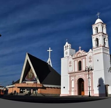
With the arrival of Hernán Cortes and his Spanish troops, the indigenous groups were subjected and the processes of evangelization began by the Franciscan friars, who were responsible for building one of the most important temples in the area: the Parish of Our Lady of Guadalupe.
The place was entrusted to the Spaniard Francisco de Villegas on November 18, 1535. According to existing documents in the municipal archive of Felipe IV, sent to Viceroy Lópe Díez de Armendáriz, on January 8, 1639 Rodrigo Trasloceros y Arlenguerque took possession of the land and founded Santa María Atlacomulco.

In the period of Independence it was a strategic place through which various insurgent groups passed, in fact, some of them settled in the sanctuary “Lord of the Garden”. After the conflict, the State of Mexico was officially constituted, and on August 4, 1824, “the first Act of Cabildo oldest existing in the historical archive” was signed, a date that was conventionally chosen to designate it as the day on which the municipality of Atlacomulco was legally or legally constituted”.
During the Porfiriato, the first schools, roads are installed and public lighting arrives in the region. The economic development of some farms also began and the boom of gold mines began thanks to the construction of the railway.
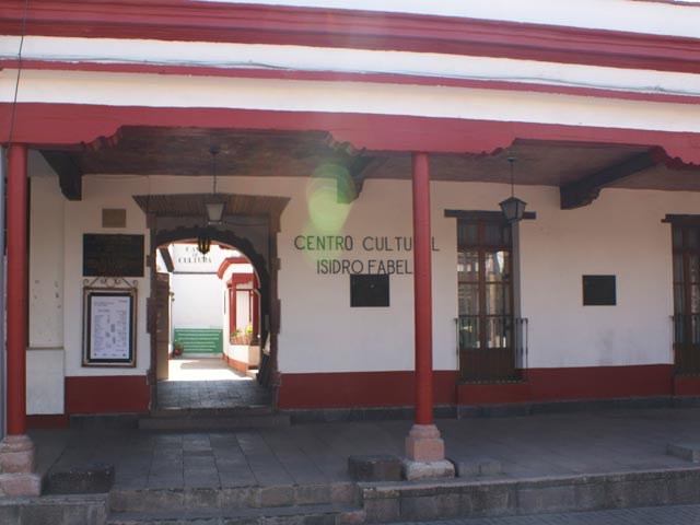
The town also stands out because it was the place where renowned politician and lawyer Isidro Fabela was born, who was built a cultural center in his honor to foster a taste for artistic activities.
The territory currently covers an area of 258.7 km² and has a total of 109,384 inhabitants, of which 52.3% are women and 47.7% men.
KEEP READING:
Últimas Noticias
Debanhi Escobar: they secured the motel where she was found lifeless in a cistern
Members of the Specialized Prosecutor's Office in Nuevo León secured the Nueva Castilla Motel as part of the investigations into the case

The oldest person in the world died at the age of 119
Kane Tanaka lived in Japan. She was born six months earlier than George Orwell, the same year that the Wright brothers first flew, and Marie Curie became the first woman to win a Nobel Prize

Macabre find in CDMX: they left a body bagged and tied in a taxi
The body was left in the back seats of the car. It was covered with black bags and tied with industrial tape
The eagles of America will face Manchester City in a duel of legends. Here are the details
The top Mexican football champion will play a match with Pep Guardiola's squad in the Lone Star Cup

Why is it good to bring dogs out to know the world when they are puppies
A so-called protection against the spread of diseases threatens the integral development of dogs


